Vehicle-Based Data Acquisition System
The ChallengeThe government has standards that must be met to ensure that the stripes on the roadways are visible to help prevent accidents.
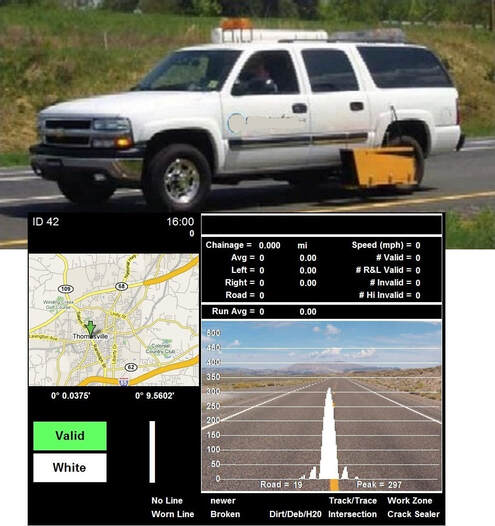
The customer wanted a system to measure and analyze the retroreflectivity of the stripes at driving speed. They wanted to be able to process the results automatically in real time during collection. The system also needed to collect GPS data and record video of the entire process with data overlaid. This would provide proof of compliance as well as helping road maintenance crews to know where repairs are needed. The SolutionWe created a system that uses a laser to scan the road and takes high speed measurements at driving speed. The data is processed and stored in the vehicle during an inspection cycle. Video is recorded with an overlay of the scanned data and map location of the scan location.
Upon returning to the dispatch center, the data and video is uploaded to a server. From there, the data is made viewable through an online interface. The user is able to view the data very intuitively as shaded color overlaid on the roads that were scanned. The system highlights the areas that require repair, making it easy for municipalities to make plans for repairs. |
The Technical DetailsThe system uses three interconnected computers that work together to collect and process the data and video in real time.
The system features include:
This system was created using National Instruments DAQmx boards for I/O interfacing. The software was developed in LabVIEW. Online data access developed with PHP, MySQL, and Google Maps. |


